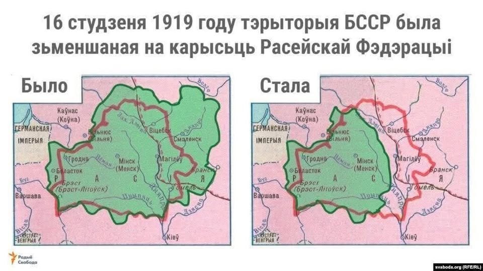
Left (“Was”): The territory of Soviet Belarus (SSRB) as of 1 January 1919, when it was proclaimed in Smolensk. At that time, it included the Vitebsk, Mogilev, and Smolensk provinces.
Right (“Stal”): The territory after 16 January 1919, when, by decision of the Central Committee of the RCP(b), the Vitebsk, Mogilev, and Smolensk regions were separated from Belarus and annexed to the RSFSR (Russian Federation).
The map accurately conveys a historical fact: two weeks after the creation of the Soviet Socialist Republic, the Bolshevik leadership in Moscow unilaterally reduced its territory by almost three times.
These events are known as the first dismemberment of Soviet Belarus, which sparked protests even among local Belarusian communists.
You can read the details of this story at the link: The Disintegrated BSSR – Wikipedia https://be.wikipedia.org/…/%D0%A3%D0%B7%D0%B1%D1%83%D0…
Oleksandr Yasenchuk
Facebook