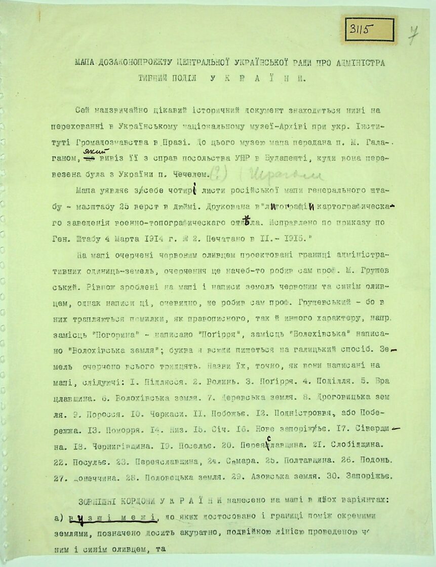
Description of the map to the law on the administrative-territorial division of the UPR dated 06.03.1918. The Ukrainian counties of the Voronezh Governorate at that time formed an administrative-territorial unit called Podon, with its centre in the city of Ostrogozhsk.
The document is a description of a map on which the borders of the UPR are outlined according to the Third Universal. The description was created by an employee of the Ukrainian Historical Cabinet in Prague in 1928.
The map itself has not yet been found.
Source: TsDAVOU, fund 3866 “Ukrainian Historical Cabinet in Prague”, op.1, file 49
The problem of locating the map, as well as other documents from Ukrainian émigré archives in the Czech Republic, is that after their transfer in the 1940s–1950s from Czechoslovakia to the USSR, the formed collections were transported haphazardly, in bulk, and after long processing by NKVD employees (for the purpose of creating a card index on Ukrainian nationalists and their possible connections in the USSR — over 82,000 people), new collections were formed from the files in various archival institutions of the USSR. A significant portion ended up in Moscow.
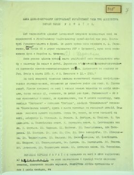
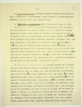
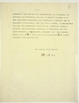
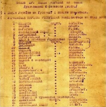
Recognised text of the document
MAP BEFORE THE CENTRAL UKRAINIAN RADA’S DRAFT LAW ON THE ADMINISTRATIVE DIVISION OF UKRAINE
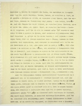
Sheet 1
This extremely interesting historical document is currently held in safekeeping at the Ukrainian National Museum-Archive at the Ukrainian Institute of Public Studies in Prague. The map was transferred to this museum by Mr. M. Halahan, who brought it from the files of the UPR (Ukrainian National Republic) embassy in Budapest, where it had been transported from Ukraine by Mr. Chechel. (?) (Schrag – pencil note)
The map consists of four sheets of the Russian General Staff map, at a scale of 25 versts per inch. It was printed by the “Lithography and Cartographic Establishment of the Military-Topographic Department. Corrected by order of the General Staff on 4 March 1914, No. 2. Printed in II. – 1915.”
The projected boundaries of the administrative units (lands) are outlined on the map in red pencil; this outline was apparently made by Prof. M. Hrushevskyi himself. Also present on the map are the names of the lands written in red and blue pencil; however, these inscriptions were apparently not made by Prof. Hrushevskyi himself, as they contain errors of spelling and other types. For example, instead of “Pohorynia,” it is written “Pohirria,” and instead of “Volekhivska,” it is written “Volokhivska zemlia”; the letter “я” is written everywhere in the Galician style.
A total of thirty lands are outlined. Their names, exactly as written on the map, are as follows:
- Podliassia
- Volyn
- Pohirria
- Podillia
- Bratslavshchyna
- Volokhivska zemlia
- Derevska zemlia
- Drohovytska zemlia
- Porossia
- Cherkasy
- Pobozhie
- Podnistrovia, or Poberezhzhia
- Pomorria
- Nyz
- Sich
- Novoe Zaporizhzhia
- Sivershchyna
- Chernihivshchyna
- Poselie
- Pereiaslavshchyna
- Slobidshchyna
- Posulie
- Pereiaslavshchyna
- Samara
- Poltavshchyna
- Podon
- Donetschyna
- Polovetska zemlia
- Azovska zemlia
- Zaporizhzhia
The external borders of Ukraine are drawn on the map in two versions:
a) Narrower borders, to which the boundaries between the individual lands are adjusted, are marked quite neatly with a double line drawn in … (possibly red) and blue pencil, and
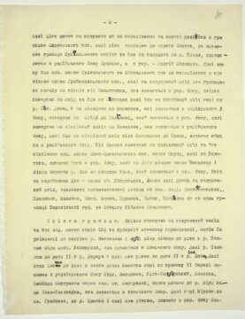
Sheet 2
b) the wider boundaries are marked with lines of violet chemical pencil, with breaks and splits in some places, and parallel to the line of the narrower boundaries in other places.
A. Narrower boundaries of Ukraine (place names exactly as on the map)
Western boundary. The line begins at the mouth of the Dniester and goes upstream along the Dniester to the mouth of the Zbruch River. Then upstream along the Zbruch to the beginning of the land border between Russia and Austria, along this border westward to a point west of the Austrian settlement Narol, from where it turns north and goes through Kholmshchyna via Yuzefov, Zvezhinets, Shchebrzheshin, Tvorychevo, Stav, Izbitsa, Krasnostav, between Zhulyn on the Ukrainian side and Faislavitse on the Polish side, through Travniki St., through Dorogucha, Lenchna, Podribye, to the Tysmenytsia River, along the river to the town of Ostrova, then along the left bank of the same river below Chemernyky, through Radin, Shustka, Drelyon, Sytsyna, Hushlev, north along the road from Hushlev to Sarnak up to number “21”, leaving Losice on the Polish side. Then it turns east and crosses the Western Bug River opposite the town of Nemirov, Grodno Governorate.
Northern boundary. From the town of Nemirov, the line goes northeast through Volchyn, crossing the railway near numbers “17”, “18”, leaving Lyschytsi St. on the Ukrainian side and Vysokolytovsk on the Belarusian side, then goes to the Lesna River opposite Oleshkovychi, then upstream along the Lesna through Kamenets-Litovsky, then to the bend of the river to the north opposite Chemera, which remains on the Ukrainian side, through Khidry, Shereshevo, Kotelky, Pruzhany, Vorozhbyty, Selets, and Kosovo. Then it passes near Yahlevychi, which remain on the Belarusian side, to the border of Grodno and Minsk Governorates, then along this border to Lake Vyhonovychi, from there eastward to number “20” north along the road from Khotenychi, which remain on the Ukrainian side, to Liubashevo, which remains on the Belarusian side. Then south of Liubashevo, it crosses the railway and goes east between V. Krugovychi on the Belarusian side and Denyskovychi on the Ukrainian side, crossing the Lan River above Chudzyn, then…
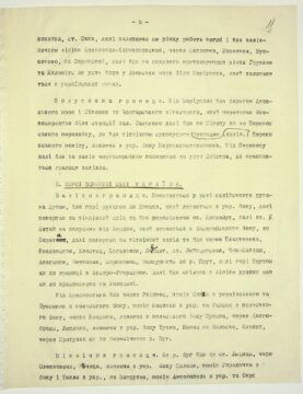
Sheet 3
Crosses the Moroch River south of Vyznya, which remains on the Belarusian side, passes through Zaušnitsy, Chepeli, Pogost, where it crosses the Sluch River, then along the road from Pogost to Lyuban, where it crosses the Orissa River, then passes through Hlusk, leaving on the Belarusian side the road and the villages of Chabusy and Mezhylise.
From Hlusk, it goes through Borovaya, where it crosses the Berezina River, then through Nov. Step, Krasn. St. Bereg, where it crosses the railway from Zhlobin to Bobruysk. Then it goes east and below the number “25” crosses the railway and highway from Zhlobin to Luchin, which remains on the Belarusian side.
Next, it crosses the Dnipro River, goes through Gorodets, then along the road from there through Rogin, near Lechora St. It then crosses the highway from Gomel, leaving Merkulyovichi on the Belarusian side, then turns southeast and goes through Shepetovichi to the Sozh River, then along this river to the mouth of the Besed River, upstream along the river, and without reaching Nov. Hromyky, which remain on the Belarusian side, goes to Svyatsky, then turns north and follows the administrative border between the Chernihiv and Mogilev governorates up to the latitude of Lotaki, where it separates from this border and turns east, leaving the protrusion of the Surazh uyezd with the settlements Biryuli and Medvedki on the Belarusian side, and goes north from Lotaki and Zaborie to the Desna River.
Then, it follows the administrative border of the Chernihiv Governorate, up to the latitude of Degtyarovka, where it lowers the administrative border and goes through Degtyarovka, then upstream along the Iput River, again along the administrative border, leaving Kotolin on the Belarusian side and Molodkovo on the Ukrainian side.
It continues, following the administrative border between the Chernihiv and Oryol governorates up to the intersection with the Kursk Governorate border, then along this border to the latitude of Amon, where it leaves the administrative border and goes through Amon, then turns south and passes through Makeevka, Rylsk, then bends northeast along the Seym River up to the latitude of Ivanovskoye, which remains on the Russian side, then goes to a railway point marked with the number “25”, then southwest along the railway to Korenevo. From there through Pogrebki, where it crosses the Sudzha–Lgov railway. Then it goes northeast, following the administrative border of Sudzha and Lgov uyezds, up north of Kostornaya, where the border with Kursk uyezd begins.
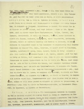
Sheet 4
Then, along this border to the south up to the intersection at the latitude of Meshchanka with the border of Oboyan Uyezd, then along this border to the latitude of Oboyan, where it leaves the border of Sudzha Uyezd and goes south to the Psel River, leaving Bushmino on the Russian side and Dolhyi Kolodez on the Ukrainian side.
Next, it again follows the administrative border of Sudzha and Oboyan uyezds up to the intersection with the northern boundary of Grayvoron Uyezd, then southeast along this boundary to the bend north of Bessonovka, which remains on the Ukrainian side, from where it turns east and goes toward Belgorod, then northeast along the Seversky Donets River and, not reaching Podolka, which remains on the Russian side, turns east to Poltavets, which remains on the Ukrainian side, then turns northwest to Kholodnoe, which remains on the Russian side, then northeast near Skorodnoe to Orlik, leaving both on the Russian side.
From Orlik, it turns southeast and follows the northern administrative border of Novo-Oskol Uyezd through Okuni, then to Volotovo, leaving it on the Ukrainian side, then east along the river through Vepyevka and along the left bank of the Don River downstream to Uryv, which remains on the Russian side. From there, crossing the Don via Pokrovskoe St., Liski, then along the Don southeast, leaving the following settlements on the Russian side: Novopokrovskoe, Pavlovsk, Kazinka, Nizhny Mamon, Zhuravka, Bychok, Pogreloe, up to the administrative boundary of Voronezh Governorate and the Don Cossack Host Region.
Eastern boundary. From here, it turns southwest and follows the administrative boundary between regions and governorates, first Voronezh, then Kharkiv, up to the source of the Nagolnaya River, then along this river to its mouth in the Polnaya River near the village of Voloshkina, which remains on the Don side. Then along the Polnaya River to its mouth in the Derkul River, and further along this river to its mouth in the Seversky Donets. Then downstream to its mouth in the Kamenka River, upstream along the right bank, leaving Verkhnye Shevyrevo, Ust-Teplinsky, Kamenka, Sloboda Kartushina on the Ukrainian side, via the railway station Kartushino, through Shchetovo to the Mius River above Novo-Pavlovka, which remains on the Don side. Then upstream along the Mius to the village of Grabovaya, to the Krynka River, and along this river, leaving Olkhovatka on the Ukrainian side.
Sheet 5
Saky St., then, leaving this river, makes a bend and follows the Krynychna–Khanzhenkivska railway line, through Shcheglovka, Makeevka, Mushketovo, on Zaryanskaya, then goes south, following the Gruzkaya and Kalmius Rivers to their mouth in the Sea of Azov near Mariupol, which remains within Ukrainian boundaries.
Southern boundary. From Mariupol, it goes along the shore of the Sea of Azov and the Syvash to the Chonhar Peninsula, which it crosses directly near the railway station Salkovo, then along the Syvash to the Perekop Isthmus, where it follows the northern land (administrative) border of Perekop Uyezd, leaving Pervokonstantynivka on the Ukrainian side. From Perekop, it continues west along the Black Sea coast to the mouth of the Dniester, where the western boundary begins.
B. Wider external boundaries of Ukraine
Western boundary. Begins at the mouth of the Kiliya branch of the Danube, goes upstream to Izmail, which remains on the Ukrainian side, then turns northeast and passes, crossing Lake Kotlabukh, then Lake Kigai south of Kordon, which remains on the Bessarabian side, to Sarata, then turns northwest and goes through Plakhteevka, Vvedenskoe, Klyastits, Kogilnik, Leipzig, st. Leipzigskaya, Chok-Maidan, Dezginzhe, Beshtamak, Korpineny, Balaureshty to the Prut River, then upstream along the Prut to the border with Austria-Hungary. Then it follows the line of the narrower boundaries up to Krasnostav in Kholmshchyna.
From Krasnostav it goes through Reyovets, between Savin on the Ukrainian side and Bussovno on the Polish side, between Matsoshyn on the Ukrainian side and Hansk on the Polish side, through Wlodawa, leaving Sukhava on the Polish side, through Dolgobrody, Lypynky, leaving Tuchna, Pishchats in Zalesie on the Ukrainian side, Olshin, through Pratulin to the crossing of the Bug River.
Northern boundary. From the Bug River it goes to Lyschytsi St., through Oleshkovychi, Rechytsa, leaving Pylyshche on the Ukrainian side, between Horodechna on the Belarusian side and Tevly on the Ukrainian side, at Zaprudye, between Antonopol on the Ukrainian side and Okro… (possibly: Okrovo).
Sheet 6
On the Belarusian side, between Dorogichin on the Ukrainian side and Khomsk on the Belarusian side through Gutov; between Motol on the Ukrainian side and Telekhany on the Belarusian side through Malkovichi, leaving Ploskino on the Ukrainian side. Then it continues downstream along the Tsna River to Lakhva, where the line splits: the southern branch follows the Tsna and Pripyat Rivers to Mozyr, and the northern branch runs from Lakhva through Lenino, directly south of Lake Knyaz-Zhid and south of Starushka and Kopatkevichi to Mozyr.
From Mozyr, it goes to the left bank of the Pripyat River to its mouth in the Dnipro, then upstream along the Dnipro and Sozh Rivers to Nov. Yaryloviči, then north through Rudnya Pribytkovskaya, Dobrush, Sivenky, Nov. Gromyky, Svyatilovichi, west of Bolsuna, Polesie, through Amkhinichi north of Biryuli, Medvedka, Kiselevka, through Belyvkovichi, Degtyarovka, Katolin, Kasheno to the midpoint between Kasheno and Bryansk, from where it turns southwest, leaving on the Moscow side Poluzhye Borachevka to Krasny Rog, Semets, Sagutyev, in a straight line to Golubovka, Kamenka, Mikhailovsky khutor, Svesa, Esman, Krupets to the Seym River, leaving on the Ukrainian side the Belopolie–Glukhov railway at st. Krupets, Markovo.
Then it follows upstream along the Seym to Lgov, which remains on the Russian side, east of Derevenka to Soldatskoye up to the latitude of Sudzha–Oboyan, and goes north of Belitsa, then turns east and goes north of Oboyan, then along the Oboyan–Kleinmihelev railway, then north of Troitskoye–Ploskoye, south of Gushchino, between Tepliy Kolodez on the Russian side and Saltykovo-Rozhdestvenskoye on the Ukrainian side, then north of St. Oskol; south of Terekhovо, north of Rogovatoe–Pogoreloe, south of Istobnoye, north of Krasnoe, south of Osokino via Uryv, Staropokrovskoe along the left bank of the Don to the mouth of the Bityug River, from there east through Losevo south of Livenka to Buturlinovka, which remains on the Ukrainian side north of Velikoarkhangelskoye, from Vasilyevka (Vodyanov), from Burlyayevka, from Pykhovka to Novokhoperesk.
Eastern boundary. From Novokhoperesk, it turns south and follows at some distance along the right bank of the Khoper River to Upornikovo on Stepanovsky Popov, through Shirkov, Popov, to the Don, leaving Gorbatov on the Don side, on the Ukrainian side — Dulenkov, Evlantiev, then goes to Krasnokutskaya, Vyacheslavov, Kuznetsov, Ermakovsky, Milyutinskaya, then along the left bank of the Gnilaya River.
Sheet 7
Leaving on the Ukrainian side Lukichev-Sulin, the settlement Skasyrskaya, on the Don side — Chernozobov, then goes to Obryvsk (Karpov) up to the Don River above Ekaterinoslavskaya, between Grushevskaya on the Don side and Sadkovsky on the Ukrainian side, then goes to Kireevo, to Alexandrovsk Grushevsk, through Popovskaya, Persiyankovskaya, Grushevskaya, leaving Bolshinsky, Aksayskaya on the Don side, to Nakhichevan; then goes through Olginskaya, Povomanichsky, Korolkov and along the left bank of the Manych River to Lake Manych and then east along the administrative border of the Stavropol and Astrakhan governorates.
Translated by Tymish Olesiuk.
12/XII 1928.
The material was prepared by the co-founders of the national liberation movement “Eastern Slobozhanshchyna”, Andrey Voron and Nina Belyaeva.